Tag Archives: Walk Difficulty: Easy

Pat Holder’s Home Butterfly Garden (Asheboro, NC)

On Saturday, June 15, 2024, the Triad Chapter of CBS (Carolina Butterfly Society) will hold a butterfly walk at Pat Holder’s native plant home butterfly garden in Asheboro, North Carolina. There will be safe parking on the side of the country road as well as a little parking in Pat’s driveway.

If you would like to attend, please contact Pat Holder at the email address below to RSVP and obtain her address (which, for privacy and security concerns, is not published here).

Historic Bethabara Park (Winston-Salem, NC)

On Saturday, June 18, 2024, the Triad Chapter of CBS (Carolina Butterfly Society) will hold a butterfly walk at the Historic Bethabara Park Butterfly Garden. The Bethabara Gardens are beautiful, historically significant places to explore. When the Moravians settled Bethabara in the early 1750s, one of the first things they established were the gardens. The Pollinator Garden was not planted by the Moravians, but this new garden preserves their tradition and values of respecting and understanding of the balance of nature. The entire park encompasses 183 acres of preserved wildlife, historic buildings and grounds, walking and birding trails, and protected wetlands but we will initially be exploring the garden listed above. Refer to the website below for a map and additional information.

The park address is 2147 Bethabara Road, Winston-Salem, North Carolina 27106 (or for those who prefer GPS coordinates, 36.15470, -80.29618). Please RSVP to Bernyce Pritchard at the email address below if you plan to participate.

Wateree River HP & WMA (Eastover, near Columbia, SC)

The Carolina Butterfly Society Midlands Chapter will hold a butterfly walk on Saturday, October 12, 2024, at the 3,674-acre Wateree River Heritage Preserve and Wildlife Management Area. Our target species is Southern Dogface, but we will also be looking for other late-season butterflies as well. We will drive to various areas, walk some of the trails and quite possibly “bushwhack” through fields following the elusive Southern Dogface. Some areas may be a little overgrown, but the walking is mostly on level ground and easy.

Meet at the first kiosk that is located on the right, about 0.45 miles along Goodwill Road after entering the property. GPS coordinates for the kiosk are 33.9495, -80.6530. The HP / WMA entrance is located at 15001 Goodwill Road, Eastover, SC 29044 (GPS coordinates 33.9435, -80.6555) on the north side of Garners Ferry Road, US Highway 378, just across from Goodwill Baptist Church.

No restrooms are available on the property. Refer to the SCDNR website link below for additional information and maps of the property. Either register on the CBS website or RSVP to Marty Kastner at the email address below if you plan to participate. Please bring water, lunch, binoculars, cameras and field guides. Sunscreen, bug spray, long pants and close-toed shoes are highly recommended.

See the website link below for hiking trails and other information about the Wateree River Heritage Preserve and Wildlife Management Area.

SI Group Hundred Acre Woods – Goatweed Leafwing (Orangeburg, SC)

On Saturday, September 7, 2024, the Midlands Chapter of CBS (Carolina Butterfly Society) will hold a butterfly walk at the SI Group Hundred Acre Woods in Orangeburg, South Carolina, to look for the Goatweed Leafwing (we believe there is an existing, ongoing colony) and other fall butterflies. There will be a short drive on an unpaved road to get to our staging point, and, after parking, we will walk around the property.

There is a porta potty on site. Restaurants and gas stations are nearby. The walk will be on flat ground, but some field areas may be overgrown.

The address is 725 Cannon Bridge Road, Orangeburg, SC 29115 (GPS coordinates 33.465095, -80.884050). Traveling south on Cannon Bridge Road from Highway 301, go past the railroad crossing and come in the third entrance on the left just after the main parking lot area for the SI Group and just before the fenced-in electrical substation enclosure. After turning in, look to your right and follow the short dirt road, on the east side of the electrical substation enclosure, towards the tree line where we will meet and line up our cars. After everyone has arrived, a safety officer from the SI Group will lead the caravan of cars back to the Hundred Acre Woods parking area.

Please register online at the CBS website or RSVP to Diane Curlee, our trip organizer, at the email address below if you plan to participate.

Gum Swamp Road (Jackson, SC)

This is a CBS Midlands Chapter outing to areas near Aiken, South Carolina, to look for the Texan Crescent, Tawny Emperor, Hackberry Emperor and other summer butterflies. Please note that this event is on Sunday, where we will drive along Gum Swamp Road and stop at various locations along the road to explore areas of interest (or wherever we see butterflies). The gate to the lakes (see below for the location) will be open at dawn if you want to do some birding before our butterfly walk.

We will meet at the Kathwood Lakes parking area (GPS coordinates 33.33728, -81.84345) of the Silver Bluff Audubon Center and Sanctuary. We will leave some cars at this location and consolidate the number of vehicles. Kathwood Lakes is located on Silver Bluff Road just before the paved road turns to dirt and approximately 200 yards after crossing the railroad tracks coming south. Kathwood Lakes is the name Google Maps uses for the bodies of water at this location.

If you are coming from the north, Beech Island is the nearest place with bathrooms, places to eat and gas stations. If coming from the south, Jackson is the nearest place for these items. If coming from the east down Silver Bluff Road, (SC 302), Aiken will be the last town on your way. Jackson will be to your south on SC 125 if you need to stop just prior to the meeting spot.

No restrooms are available along Gum Swamp Road. Please RSVP to John Demko at the email address below if you plan to participate.

Super-Sod Farm and Surrounding Area – (Orangeburg, SC)

The Carolina Butterfly Society Midlands Chapter will explore areas around and possibly inside the Super-Sod Farm in Orangeburg, South Carolina. Our target species is the Common Sootywing which has been recoded here in the past.

Meet at the Super-Sod office at 3086 Five Chop Road, Orangeburg, South Carolina, 29115. The GPS coordinates are 33.45936, -80.74331.

Please bring water, lunch, binoculars, cameras, sunscreen, and bug spray. Long pants and close-toed shoes are recommended. Dennis Forsythe will lead. Please register on the CBS website or contact Dennis at [email protected] if you can attend.

Weymouth Woods Sandhills Nature Preserve & Sandhills Gamelands (NC)

Saturday June 1, 2024 – Weymouth Woods Sandhills Nature Preserve

We will meet at the Weymouth Woods Sandhills Nature Preserve Visitor’s Center at 9:00 a.m. The visitor’s center address is 1024 N Fort Bragg Road, Southern Pines, NC 28387 (with GPS coordinates listed on the website as 35.1470, -79.3715). The GPS coordinates for the entrance to the visitor’s center from N Fort Bragg Road are 35.14681, -79.37183.

This location offers a pleasant walk through stands of pine forests. Pathways are packed sand. We will likely visit the Paint Hill Tract while at Weymouth Woods, and if time allows, we may make a stop at Sandhills Community College.

Sunday June 2, 2024 – Sandhills Gamelands

We will meet at the BP gas station in Hoffman, NC at 9:00 a.m. The gas station address is 2183 Caddell Road, Hoffman, NC 28347 and the GPS coordinates are 35.02646, -79.55963.

From the gas station, we will venture in to the Sandhills Gamelands to explore the various sand roads, pine stands, creeks, and lakes to see what we can turn up. Road conditions in the Sandhills Gamelands can be tricky at times. The roads are sand and are fairly solid but after wet weather can be difficult.

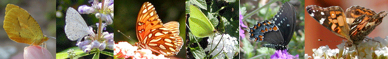
Target species are the King’s and Edward’s Hairstreaks. Additional species commonly seen are Palamedes, Spicebush, and Tiger Swallowtails; Common Buckeyes, Eastern Tailed Blues and Azures, and assorted duskywings.

It is recommended that you bring additional snacks, food, and beverages as during the walks we will be away from public facilities. Wearing sturdy walking or hiking shoes is recommended along with long sleeves and pants as we may go off trail in some locations to look for as many butterfly species as possible. It is also recommended you use a good bug spray, wear sunscreen, and carry water with you. Be sure to bring those items you may need (camera, binoculars, field guides, etc.) to ensure a pleasant experience.

Rob Gilson, who can be reached at the email address listed below, is the leader for these field trips. Please either contact Rob or register on the CBS website if you plan on attending.

NABA Butterfly Count (CSRV, Aiken County, SC)

On Saturday, July 6, 2024, NABA (North American Butterfly Association) will hold a butterfly count in the CSRV (Central Savannah River Valley) at the Silver Bluff Audubon Center in Jackson, South Carolina. Audubon’s Silver Bluff Sanctuary is a 3,400-acre woodland overlooking the Savannah River. Here you’ll find extensive pine forests and bottomland hardwood forests; beautiful walking trails; 50 acres of lakes and ponds; 100 acres of grassland; and all manner of birds, butterflies and wildlife. Refer to the website below for specific directions and additional information about Silver Bluff Sanctuary.

Meet at the Silver Bluff Audubon Visitor Center in Jackson, South Carolina. The GPS coordinates for the gate just outside the visitor center are 33.32451, -81.84501. The street address is 4542 Silver Bluff Road, Jackson, SC 29831. Please RSVP to John Demko at the email address below if you plan to participate.

Important note: Using the street address, some GPS systems tell you that you’ve arrived one mile before you actually reach the Silver Bluff gates. At that point, Silver Bluff Road transitions from a paved road to a well-maintained sand/clay road. Continue driving for one more mile and you’ll see the gates on your right. As stated earlier, the GPS coordinates above are for the gate located just outside the visitor’s center.

Black River Cypress Preserve, Swampside Tract (Andrews, SC)

The Midlands Chapter of CBS (Carolina Butterfly Society) will explore the Swampside Tract of Black River Cypress Preserve near Andrews, South Carolina. This preserve is privately owned and groups are admitted by appointment only. Please note that we need to have at least 6 people attend and each must sign a waiver upon arrival.

The Cypress Preserve offers a unique opportunity to experience some of North America’s most diverse and exotic ecosystems—from mysterious black water swamps and rivers to sparkling pine savannas. We will explore via winding hiking trails that feature interpretive signs and plaques, identifying the flora and fauna that have evolved in these landscapes over millennia.

We will meet in the parking lot near the main entrance. The preserve address is 16368 County Line Road (Hwy 41), Andrews, South Carolina, 29510. GPS coordinates for the preserve entrance that leads back to the parking area are 33.4988, -79.5341.

Restrooms are available on the property. Please RSVP or send any questions to Tom Austin at the email address below if you plan to participate.

Sumter National Forest Long Cane District (Edgefield, SC)

We will walk Lick Fork Road, FS-634 to Horn Creek, and possibly Miller Branch Road. These are dirt roads with Prunella vulgaris and in some spots there are some relatives of Black-eyed Susans. We’ll meet in the Lick Fork Lake Recreation Area at the parking lot near the boat ramp. The GPS coordinates are 33.72642, -82.04029. There is a $3 per day self-pay parking fee for the area but this is only if you leave your car. We do not plan to start here so do not pay the fee. The fee is waived if you have the Federal “America the Beautiful” Pass as that covers Federal Recreation Areas as well as National Parks.

DIRECTIONS:

  • From I-20 get off at Exit 1 to Martintown Road (SC-230) and head north until you see the sign to turn right for Lick Fork Creek Recreation Area. If you get to the SC 23 intersection with SC 230 you have gone just a tad too far (less than 0.5 miles).
  • If you are coming up SC 125 from the south, take it to Martintown Road (SC-230) and head north. You will go over I-20 and then follow the directions above.
  • From the square in downtown Edgefield, travel south on Hwy-23 for 8.3 miles. Bear left onto Hwy-230 and travel for 0.4 miles. Turn left onto Lick Fork Lake Road (S 19-263) and travel 1.9 miles. The entrance is on the right.

John Demko will lead. Please let him know in advance if you are coming. There is no cell service in the areas we will be exploring. Call him at 803-761-3047 or email at [email protected] if you plan on attending.